Dog bites and midnight snow storms …
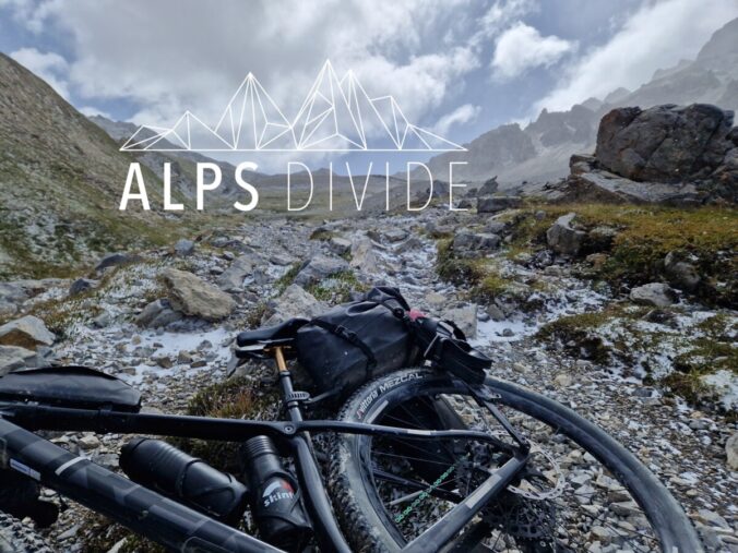
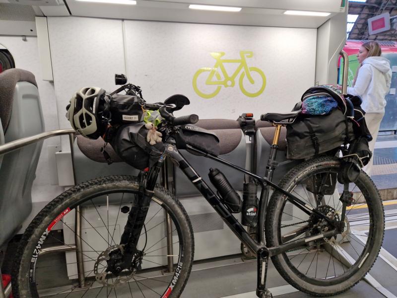
By MTB from the Côte d’Azur to Thonon-les-Bains on Lake Geneva – 1050 kilometres and 32,800 metres in elevation over the mountains along old military roads, the Via del Sale, in the face of the king of the mountains, Mont Blanc, over several famous passes – that’s Alps Divide. I accepted the challenge as a solo rider and set off with my Trek Procalibre and my mini tent.
After Panceltic Ultra and Lakes ‘n’ Knödel, this was to be the crowning glory of the season.
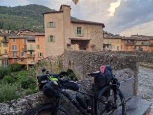
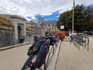
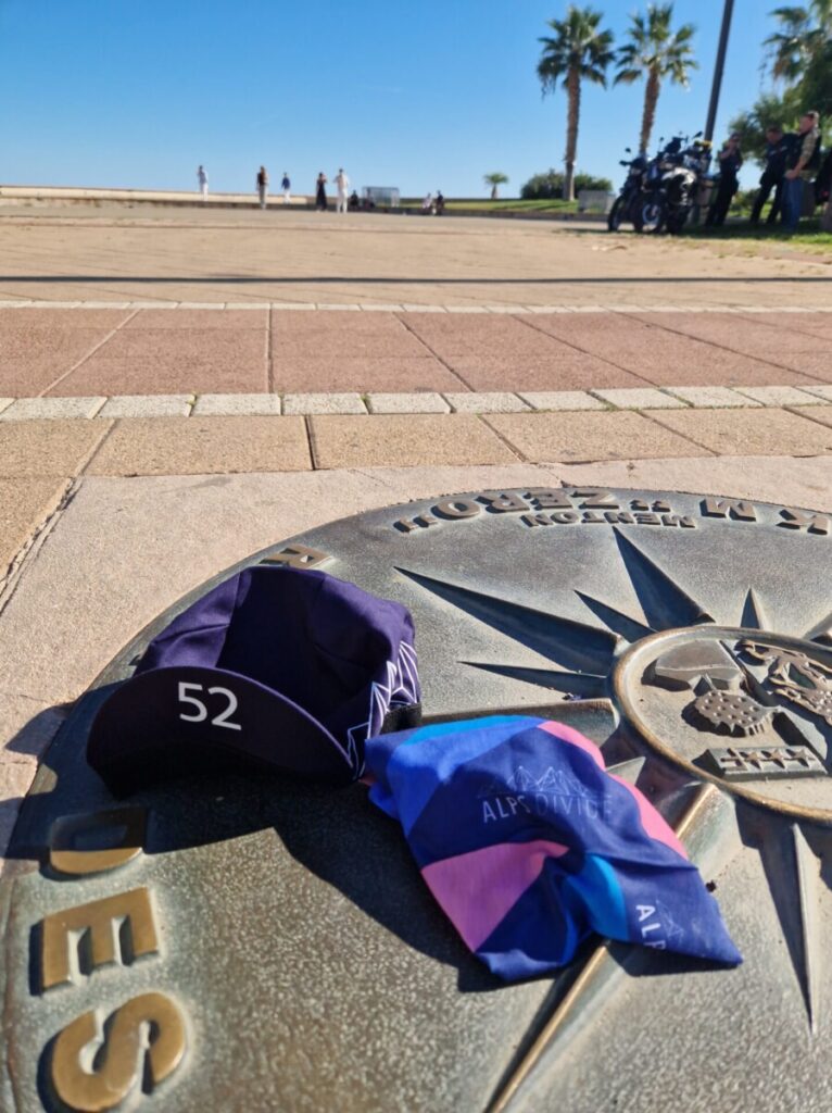
The start in Menton, the delightful little Côte d’Azur town, felt so harmless. Nobody could have predicted the difficulties that would lie in the way of the 90 or so participants and how few would see the finish line … (here are my thoughts before the race & planning)
first my video:
The race on Followmychallenge and Dotwatcher
Start Saturday, 7th September 2024
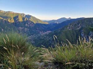
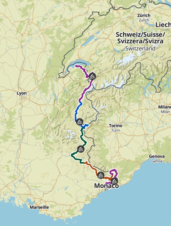
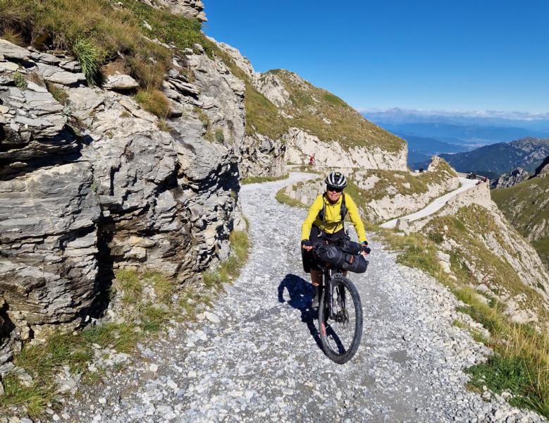
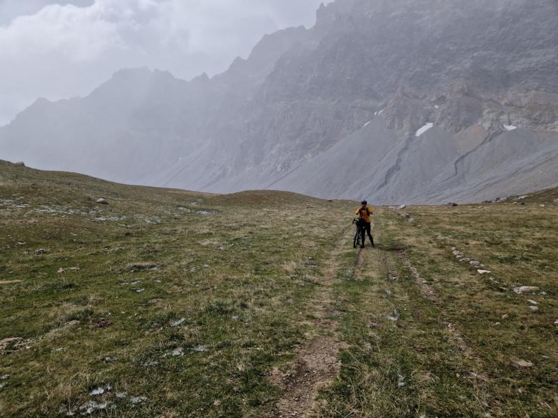
Section 1 from Menton to Tende (211 km/ 6370 Hm)
After a short briefing, we set off on time at 16:00 in the summer heat, first accompanied by the police along the palm-lined coast, then up the slope in the blazing heat at over 30 degrees. I feel like I’m about to collapse from the heat. The weather promises to be stable, at least for the moment, the field soon spreads out and I cycle along alone.
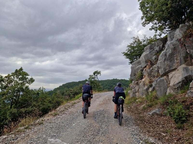
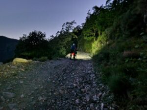
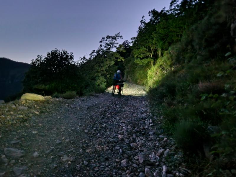
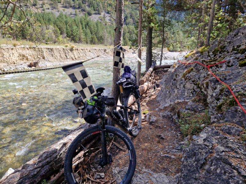
The first time I look up at the sky is when I hear the rumble of thunder – dark storm clouds had gathered. And just before Sospel. I hadn’t expected that. Nor the rough descent over a stony and rutted path. The trees seemed to offer protection, at least from the downpour that was about to start. Rain gear out. A large group meets up at the fountain in Sospel. So I’m not alone after all. I cycle on. In the rain. It’s slowly getting dark. From what I can make out in the dark, the route runs beautifully along the River Roia.
Until the route branches off and, after an inhumanly steep climb past Verrandi, finally follows an old, unmaintained military track. ‘Watch out, it’s rocky!’ write Katie and Lee, the organisers. I push my fully loaded bike uphill for a few kilometres as it keeps throwing me ungraciously out of the saddle. When Leona overtakes me on the bike, I try again.

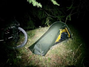
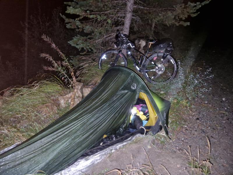
But there are always hike & bike passages. We already had that recently at Lakes ‘n’ Knödel. It’s approaching midnight. I realise my decision to bivouac for the first night near a dilapidated stable building. I pitch my tent, but lose a lot of time looking for a peg in the deep grass, which has been torn from its moorings and catapulted away. Without it, I wouldn’t be able to pitch my tent. My actions must be contagious, because within a short time the building is populated and there are two more tents nearby. A campsite, so to speak.
Sunday, 8 September 24

I drive on before dusk. A noise in the forest on the right. What was that? A kind of grunting. Before I can think any further, a juvenile wild boar gallops across the path in front of me from left to right. Quickly away! Before mummy wild boar does me any harm.
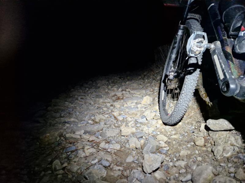
At night on the old Military Road, it is sometimes really scary. My headlight reflects in puddles and flickers through the trees. A few lines of poetry by Droste Hülshoff come to mind: O schaurig ist’s über’s Moor zu gehn … for me here: it’s scary to drive alone through the forest …
At some point, even the bad military track comes to an end, only to be replaced by an even rockier descent. Shortly before Pigna, Jo catches up with me and we exchange a few words. We will meet up several more times over the next few days.
In Pigna, a small Italian village, the pasticceria is fortunately open. Today is Sunday. I stock up on brioche and other pastries, order something savoury to take away, pizza. Freshly squeezed orange juice and the usual latte macchiato (you know: with two sugars) round it all off. I strike up a conversation with Chris, a German cyclist. The race is already over for him here. His bike had been stolen the night before. Shock! I’m usually careless when it comes to locking my bike when I’m out and about. I only have an ‘immobiliser’ with me anyway, i.e. a thin cable lock. Probably no obstacle for serious theft ambitions.
The route now climbs many kilometres and metres in elevation on tar. Rain is forecast. I chat to Jo and Martin and hardly pay any attention to the weather. Rain is forecast and the first drops are already falling. These soon degenerate into a heavy downpour. Then the first flash of lightning. I count the seconds frantically. The thunderstorm is only a few kilometres away. I get ‘legs’ and hurry. The sheltering hut is not very far away. Out of breath, I soon have to slow down and resign myself to my fate. Maybe the lightning won’t see me, I’m still below the tree line. Deceptive.
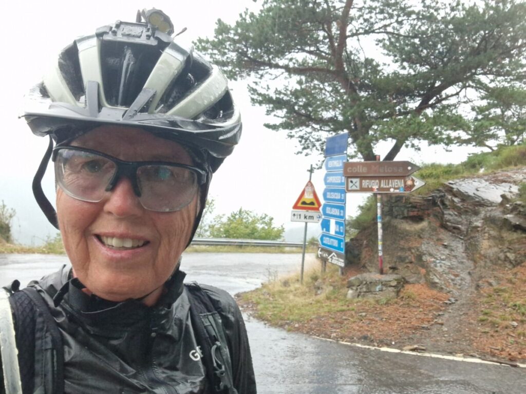
A restaurant at the end of the tarmac road. A few people have saved themselves here. Torsten and Stuart are already setting off again. The owner of the restaurant doesn’t think much of it, as the next 80 kilometres or so along the Alta Via del Sale lead to altitudes above the tree line and offer no shelter whatsoever. And it continues to rain and localised thunderstorms are forecast. However, the rooms are fully booked. I could try the neighbouring CAI hut. Bingo! The Rifugio Allavena has camps available. I’m thinking of sleeping for the afternoon and setting off again in the evening when the rain subsides.
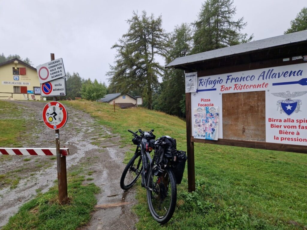
The friendly hosts look after us, a group that has now grown to over 10 people. There are showers and then a delicious lunch. Meanwhile, kilos of soaked clothes and shoes dry by the cheerfully crackling wood-burning stove. Then an afternoon nap. Or rather a nap, because I can’t sleep at this time of day.
As predicted, the rain stops around 6 p.m. and I get ready to drive. The hut people try to talk me out of my plan, because driving this route in the dark is risky. They must know. But I don’t agree and disappear into the darkness, fully loaded. I’ve not yet travelled 500 metres when the road turns into a steep, stony path and promises a lot of pushing. Stuart had predicted this when he had to return to the hut after his ascent to Passo Tanarello because he had lost his documents on the way. Poor chap! An uncomfortable wind is blowing against me and in the beam of my helmet light I can see that it has started to rain again. A saying comes to mind: ‘You shouldn’t do anything to impress others, but only what makes you happy’. Without further ado, I turn my bike round. I’m met with applause from the hut people and the other Alps Dividers as I step back through the door.
I’m just about ready for the multi-course dinner and then I zip up my sleeping bag.
Monday, 9 September 24
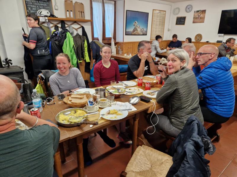
I wake up at around one o’clock and head to the breakfast buffet, which the host family have kindly prepared so that everyone can start when they want. The couple Kate and James and two girls are already ready to go. I follow them an hour later. Before driving off, I have the glorious idea of reducing my tyre pressure a little. Great driving experience! (The almost 3 bar were far too much; perhaps not bad on the first day with a few kilometres of tarmac, but off-road … no wonder it threw me around like a bouncing ball).
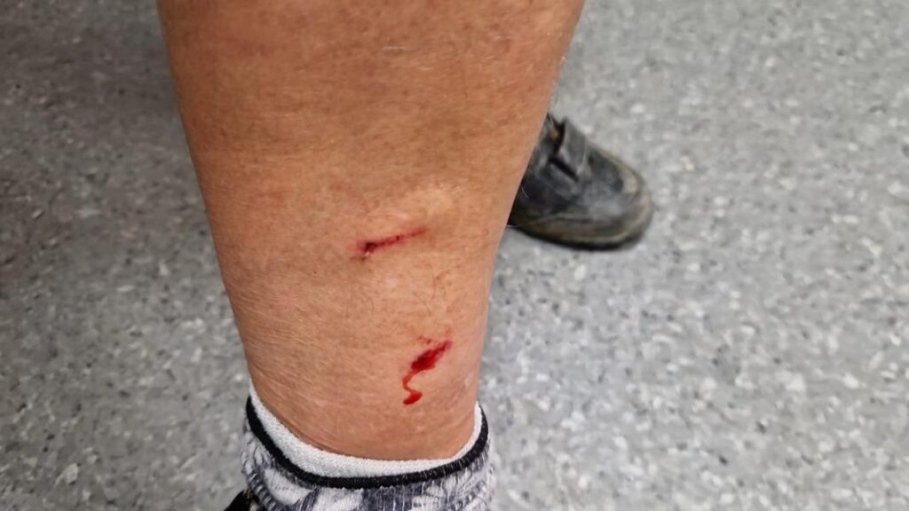
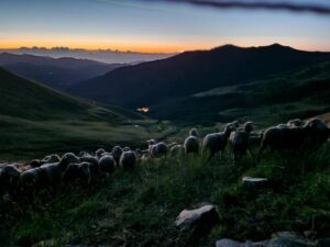
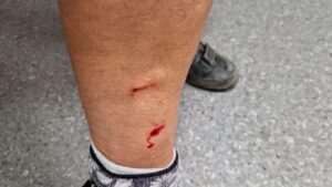
After the first mountain, there is a long descent over mountain pastures, which I can hear from the occasional ringing of bells. Dogs barking. Something brown shoots out of the forest in front of me and immediately disappears on the other side. A few kilometres further on I have to get off my bike. A medium-sized brown dog stalks towards me from behind, growling and raising the hairs on the back of its neck. No sheep or cows far and wide, but empty stables.
I talk to the animal and get on the other side of my bike. The dog does the same. Then back again. Dog too. I continue talking in a friendly manner and take a biscuit out of my pocket, holding it out to him as proof of my peaceful intentions. The dog sniffs at it briefly, but spurns the treat. After a few minutes, I take a cautious step forwards and feel something on my left ankle, as if a small stone had hit my leg, but there were no stones … it must have been the dog’s teeth. I move back to the other side. Dog too.

Another tentative step forwards and the teeth dig deep into my leg. My attacker jumps backwards at the same time and lets me go. With trembling knees, I disappear around the next bend, where I unpack my first aid kit and disinfect the bleeding wound. Ouch! A plaster over it. Fortunately, I’ve been vaccinated against rabies and tetanus and I’m not worried at the moment. But whenever I hear barking in the distance, I panic and this will happen many more times that night and the next day. At dusk, I pass sheep again. No dog. A herd of goats further down, but the shepherd is there too.

At the toll booth at the start of the Alta Via del Sale, the friendly cashier gives me his SOS emergency kit and I can clean and cover the wound, which is still bleeding heavily. Due to the constant movement while pedalling, the bite area has no rest. The man tells me that someone else was recently bitten nearby.
I drive on and look forward to the Alta Via del Sale in beautiful weather. The sun is just rising. My elation doesn’t last long, then the sound of dogs barking again. And then a whole pack of huge white animals of the pastore maremmano species leap towards me. I get off my bike in no time at all. Relief when the animals are called back.
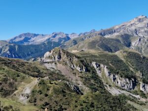
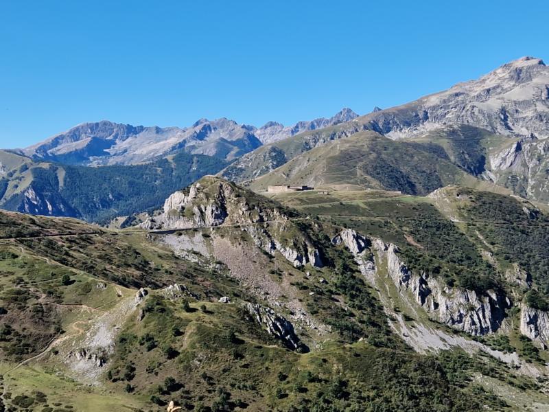
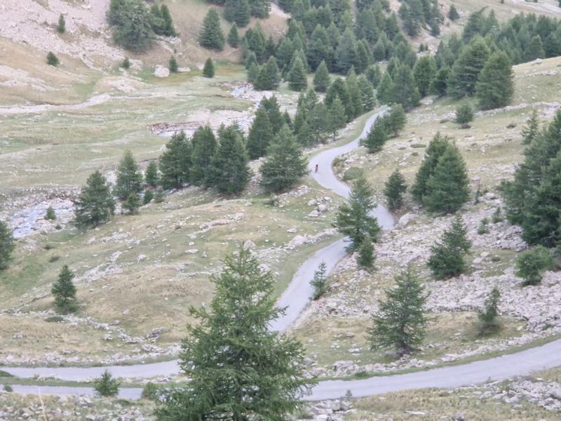
The next many kilometres along the famous old military road are breathtakingly beautiful. I leave the Rifugio Don Barbera on my right, assuming it’s just a small mountain hut. But I still have enough water and provisions anyway.
During a short break to eat, I discover that my handlebar bag is ‘flooded’ from the rain the day before. My powerbank is completely submerged in water. It’s probably ‘ruined’. I can charge my devices with the buffer battery, which is powered by the hub dynamo, but it’s not that easy. It doesn’t work in the dark, as the dynamo feeds the front light and too little power is generated when cycling uphill. So I have to plan well throughout the day when I can connect a device for charging. And now my iron power reserve is also gone …
Then back to a busier area near Limone Piemonte. I had been here twice a few years ago for a mountain run, the Grand Raid Cro-Magnon, which was cancelled once due to bad weather and heavy snowfall on the course at night. I remember back, having no idea what was to come a few days later.
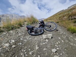
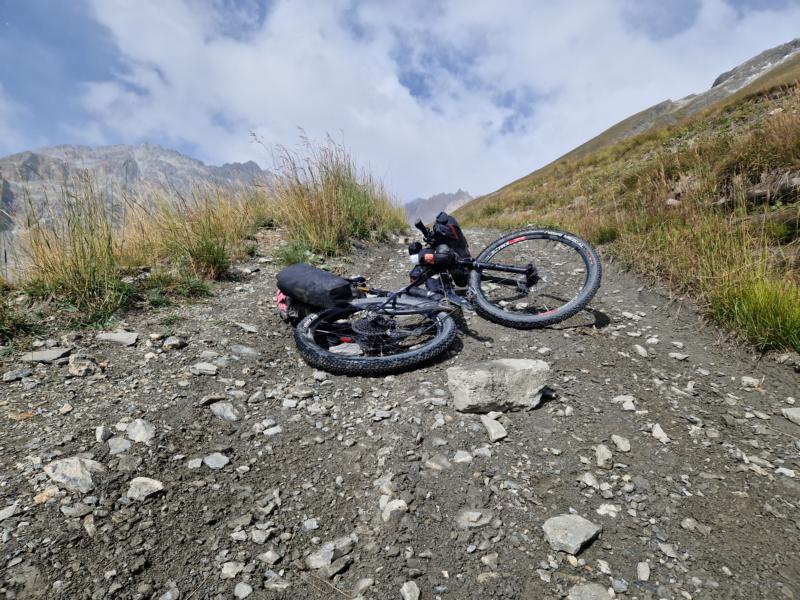
Then downhill to Tende. But not on the spectacular Colle di Tenda pass road, but on a very, very rough gravel track that really shakes me up. My wrists are soon very sore.
Section 2 from Tende to CP1 Refuge Hotel de Bayasse (196 km/ 5650 Hm)
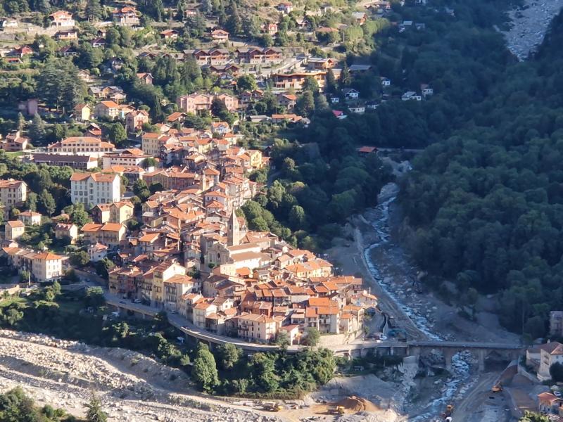
From Tende, however, a 20-kilometre-long fast asphalt descent with a tailwind is the reward. An ice cream and latte macchiato break at the petrol station and then into Saint Dalmas de Tende. There is a supermarket and a pharmacy here. The pharmacist treats me again, but says I’d better see a doctor because of the risk of infection. She is kind enough to get me an appointment. I’m soon out of hospital with a prescription for an anti-inflammatory and a probiotic.
Postscript on communication in France. I can’t speak French, for example the staff at the pharmacy only speak French. In any case, they couldn’t speak English well enough to understand my English, which wasn’t ‘good enough’ 😂. But the translator does a good job. I speak in German, it comes out in French and vice versa, they speak in French and it comes out in German and everything is fine.
At the supermarket, I meet most of the people from the fun hut tour the day before. Together we cycle towards Col Turini. When I show Jo my medical certificate, she tells me that she has also been bitten. She won’t see the doctor until the next day.
I dispose of my rubbish and, with a heavy heart, my powerbank.
A road sign points to the right, Sospel, Menton. How tempting. I still have at least 5 days ahead of me. If they turn out to be anything like the last two days, then this will probably be one of the toughest events. How good that I don’t yet know how the whole thing will develop … It’s best to think ahead step by step, so for now just until the next ‘campsite’.
On Saturday and Sunday I was so busy with the progress of the race that I couldn’t imagine talking into the recording app at some point, but now everything is a bit quieter and more cosy, it doesn’t go any faster anyway and I can chat a bit on the side. The memories of the individual days fade very quickly.
My thoughts are wandering. I’m wondering whether I shouldn’t become an opponent of wolves too. Because it’s the wolves‘ fault that I’ve wasted so much time in hospital today. If there were no wolves, there would be no need for shepherd dogs …
The ascent is 26 kilometres and 1700 metres in elevation. Night is slowly falling. I still have no idea where to sleep. On the way, I discover Kate and James‘ tent, the couple. I suddenly realise how tired I already am. A good 19 hours have now passed since I set off from Rifugio Allavena, but with only 130 kilometres and 4000 metres in elevation, which is probably due to the uneven terrain.
Taken from the bikepacker’s life: Off you go, put everything on, then when the sun comes, it gets warm, take off your sleeves and leg warmers and put them somewhere. Easy to remember, leg warmers go there, arm warmers go there, there aren’t many options, the handlebar roll, the bag at the back or the side. I remember in the morning that the sleeves are in the roll on the left, leg warmers in the roll on the right. In the afternoon I first look in the back pocket, then in the side pocket and then I remember that I could also look in the roll. I really need to come up with a system so that certain things are always packed in the same place.
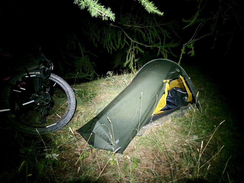
Contrary to expectations, the gravel track (‘Fahr’???) leads to a tarmac road. It’s not far to the Colle. And here is THE ideal place to sleep. I have to climb a short, steep slope, above which is a wonderful flat spot under a larch tree. I spontaneously decide to stay here and pitch my tent, with a marvellous starry sky above me. A light breeze ensures that no cold, damp fog settles over my sleeping area. It’s really cosy.
Tuesday, 10 September 24
After a short, restful sleep, I set off again. Soon I’m on the Col Turini and start the descent into the Vésubie valley. But it’s not so cool. It’s uncomfortably cold and the path is partly on wet and slippery forest floor. It’s pitch black if my torch were to fail here, I can’t imagine, I don’t even have my powerbank any more. Dogs barking somewhere. The hairs on the back of my neck are already standing on end. It’s finally dawn. Lissa overtakes me. I cycle downhill rather cautiously. We meet up in front of the boulangerie in La Bollene just before seven. Well timed, it’s just opening. And how delicious things there are here. I stock up for breakfast and during the day. Lissa tells me that her smartphone, like my powerbank, didn’t survive Sunday’s downpours and no longer works. Unthinkable.
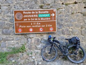
My schedule has been considerably delayed by the unforeseen events. I hope that I can still make it over the Col de la Bonette today, as the CP1 below the summit closes at 1am tonight. Maybe I could sleep there and wash my clothes. Everything doesn’t smell very good any more, especially the socks.
Further into the valley, I make another quick stop at the supermarket. I have a craving for yoghurt. I have to give in immediately, my body probably needs it right now. Then the falsopiano, the false flat, as the Italians say, is over again and I head up the first serious mountain of the day, the Col du Suc, on fantastic gravel. I catch up with Jo and Martin. Shortly before the highest point, the fine road is suddenly over. Large construction machines are laying the path and we have to be extremely careful that the workers notice our presence. And then another long descent, finally over a tarred road and into the valley of the River Tinneé. Lunch time with Jo.

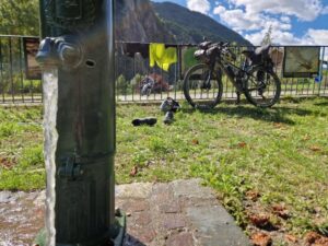
It’s very hot today. I would like to take a refreshing dip in the parallel river, but there are big signs everywhere advising against it. My salvation is a playground with a water tap. I crank up the flow of water with a swivel arm. I wash all my clothes. How I do this technically so as not to stand there stark naked is not revealed. My clothes dry on the fence for a while, still damp, which cools me down as I continue my journey.
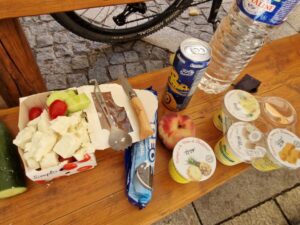
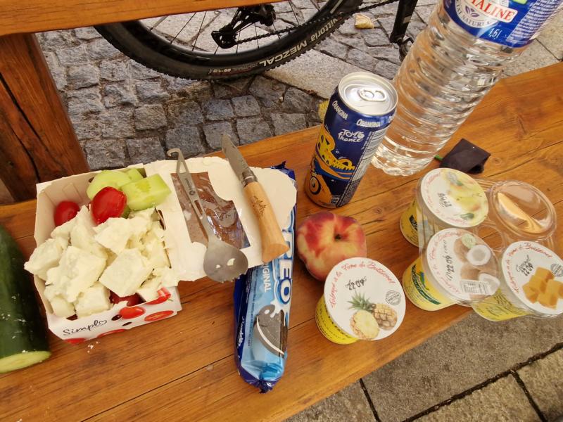
In Saint Etienne de Tinneé, a last supermarket stop with feta, cucumber and datterini tomatoes, my Greek salad, yoghurt (disgusting, tastes chemical and you always have to buy at least a four-pack), fruit and biscuits for the road.
There’s nothing left for a long time and I have to top up my reserves and probably drag them over the next mountain. I’ll probably have plenty of time there to rethink my stockpiling. I recently threw away the bread I hoarded at the breakfast buffet in Menton on Saturday after lugging it over the mountains for two days. My ready-made quinoa meal from the supermarket also just ended up in the bin; I had lugged that along too until it was no longer edible. And I probably shouldn’t keep the apple, which had brown spots all over it from shaking, for so long.

I also carry water sparingly over the summits to pour it out at the next well. I meet Kris W., who unfortunately has to give up here due to a technical defect and tells me how complicated it is to get away again. I gratefully accept his banana, I should carry it over three more mountains – just so much for sensible stock planning. laughs …
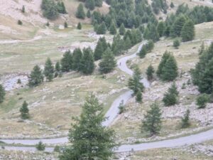
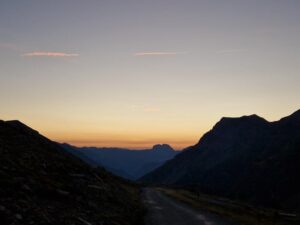
Lissa now also sets off in the direction of Col de la Bonette, whose summit is at 2700 metres. Late afternoon, I have to motivate myself with an audio book for the first time. You can drive a long way on a tarmac road. The surrounding mountains are bathed in a magical light. My motivation has somehow disappeared with the daylight since dawn. I seem to be finding it very difficult. A glance at the elevation profile explains everything: the gradient is over 15% in places. Wow!
Now I’m travelling on a natural path. The ascent is difficult. It’s getting dark. I can see Jo’s bike lights in front of me, and further down there is also a light – that must be Lissa. I have to go back down here too. I have to be particularly careful not to fall. High above me, I see a ghost of a light. Emily is coming down from the summit. A brief exchange of words. It’s supposed to be cold up there.
Surprise. I reach a tarmac road that leads in a large loop around the summit. By the time I reach the highest point, Jo has already left. I realise why. Unprotected, the storm takes full effect. Get dressed quickly and get out of here.
The descent on the ascent path is not as bad as I feared, but I don’t want to put anyone through what comes next. Further down, I see Jos‘ lamp flickering. She is making progress down there just as slowly as I am up here: The ‘path’ resembles a streambed. Driving is impossible. So pushing down is the order of the day. And even here you have to be very careful not to twist your ankle with your cycling shoes between the stones and not to be knocked over by the weight of the bike. The pushing time seems like forever. At some point a car parked at the edge. How does a car get up here? Unimaginable. But the surface has improved a bit. I try it on the saddle too. Lissa overtakes me at breakneck speed.
Finally there. At the Refuge Hôtel de Bayasse, CP1, the first checkpoint.
It’s nice and warm. Katie and her mum welcome us. We have another hot meal: quinoa with vegetables, so delicious! The living room is (almost) all girls. My brain is probably a little off after the exertions of the last few hours. I can’t remember the simplest English phrases and words and probably look a bit pathetic. But what I do understand is that almost half of the participants have already got off.
A hot, soothing shower and into the feathers of my sleeping bag. The alarm clock vibrates far too early, 5 o’clock. I set it 10 minutes later. Then I pack. My calculations show that I will be much too early for breakfast in Barcelonnette. And I have to get there when it’s open, as the next opportunity to shop won’t be until my DNF, but luckily I don’t know that at the moment. So I lie down again. Some people are snoring loudly, the air is very bad, I can’t get back to sleep and give up, exasperated. Another bad plan. If I hadn’t set the alarm clock so early …
Section 3 from CP1 to Bardonnecchia (210 km/ 5300 Hm)
Wednesday, 11 September 24
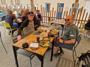
The 20 kilometres downhill are bitterly cold. I don’t want to leave the boulangerie in Barcelonnette. Only after two pain au chocolat and two cappuccinos can I pull myself together. Duncan has sat down at the next table and we have a chat. Later I’ll see that he’s dropping out of the race in Embrun. Another one of so many who have given up so far.
The route now follows an old railway line. The first tunnel is almost 2 kilometres long. I didn’t know if I was on the right track. But back here again … Oh dear!
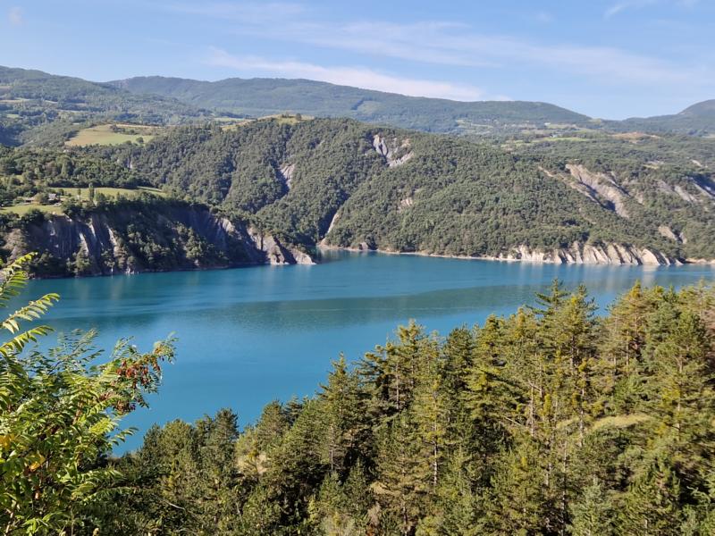
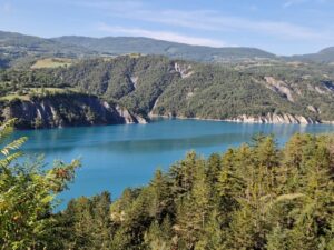
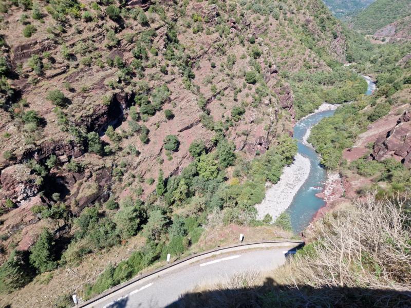
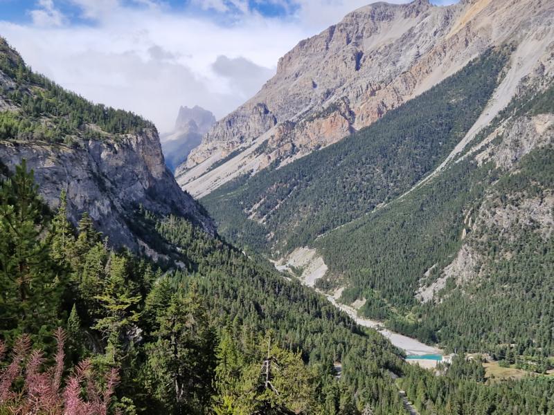
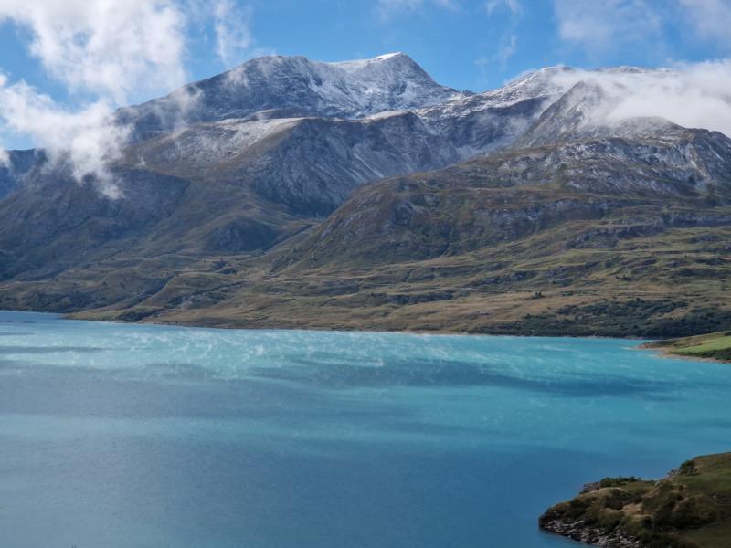
Then the huge turquoise-coloured reservoir comes into view, the Lac de Serre-Ponçon, at the other end of which I will reach Embrun. From high above, I can see the long bridge over the lake, which I crossed a few years ago during the Three Peaks Bike Race on our way from Vienna to Barcelona. But first there are two more mountains and long descents on gravel. I meet up with Marc and Webster. The climbs are entertaining with an exchange of experiences, then we part ways again – I’m just a snail on the descents. Shortly before Embrun, we meet up again at La Cantine, a super cool burger restaurant near Embrun. That’s what I love about these events. You meet lots of like-minded people and ride a bit together with one or the other. My hub dynamo isn’t charging properly, somehow. I won’t realise until later that I’ve left the front light on all day.

Before I set up camp again for the night, there is still a long climb to tackle. The route along a forest track high above Embrun must be a tourist highlight for off-road vehicle drivers. All-wheel-drive vehicles, often Belgian, keep coming towards me in packs, dust and exhaust fumes fogging me up.
I am horrified to read the word complément alimentaire on one of my boxes of medication. Food supplement? How? I had assumed that these tablets were the antibiotic. So I had been taking the antibiotic once a day and the probiotic three times a day. How stupid can you be! Hopefully that had no effect.
I reach the ski resort of Risoul and make it down to Guillestre by dusk. The village is built over a hill, I don’t want to go up there, but I have to, as I have hardly any water left.
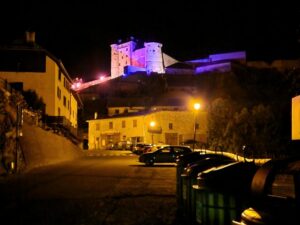
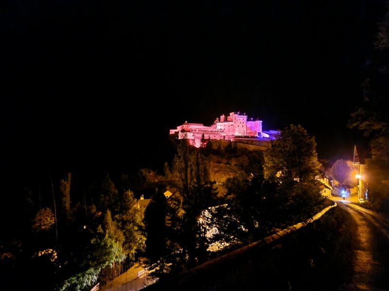
Then I cycle along the white-water kayak river, Le Guil. Too bad you can’t see anything in the dark. I meet Webster again at Château Queyras with its purple and pink illuminated castle. He has booked a chalet, but doesn’t know exactly where the village is. I’m ready for bed by 11.00 pm and start looking for a suitable place to pitch my tent.
It’s not that easy. The forest on the right is inaccessible and on the left the road drops steeply down to what we hear is a torrential stream. It also starts to drip. At some point, a steep path branches off. I can make out what appears to be a flat area at the edge of the path. I set up my tent and when I finally lie down in my sleeping bag, I realise that it’s not as flat as it seems. I keep slipping off the mat. But the tiredness and the background noise, the rushing water from the stream and the pattering of raindrops on the tent have a soporific effect.
Thursday, 12 September 24
It’s very uncomfortably cold and damp in the morning. I set the alarm for four. Then it goes to five and I set off just before six. The tent was soaking wet and even shaking it out doesn’t really help. The sleeping bag is damp on the outside. Luckily it’s no longer raining. I pour some more water into my freeze-dried meal from Firepot, ‘Baked Apple Porridge’ flavour – delicious. The packet has already travelled with me through the Panceltic Ultra and Lakes ‘n’ Dumplings. How stupid can you be? On the climb towards Brunissard I at least get warm. At a small village, I check where the others are and what awaits me in the next village, Brunissard.
Coffee and breakfast? Webster’s tracking point appears there, oh dear, the poor chap must have been at his accommodation well after midnight. I’m greeted by a very strong cold wind sweeping out of the valley and unfortunately Brunissard is probably already in hibernation, there’s nothing. The next opportunity to get supplies will probably be Briançon. But I still have to cross the Ayes Pass. And to get there, there’s a longer push section, as the organisers‘ description suggests.
A sign points to the Col d’Izoard. Unfortunately, I have to turn left into the terrain. There’s a campsite a little further on and a fountain in front of it. I’ll have at least enough water. The reception tent is just being unlocked. I could have a coffee, but unfortunately the bread is reserved for the camping guests. A man with a dog is just picking up his baguette, spontaneously tears off a third of it and gives it to me. The man at reception gives me another piece of butter. The coffee is delicious and I’m sitting in the warmth, I can even charge my smartphone.

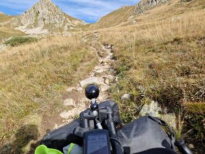
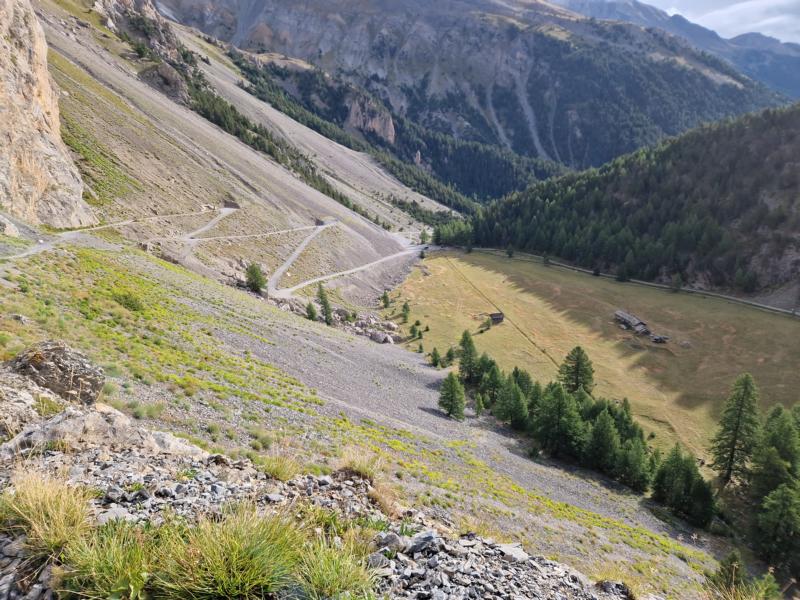
Then I have to go on. It’s getting heavy. The cold wind is still strong. A very steep zig-zag path leads uphill. I push. If this is the announced pushing section, it’s not so bad. In the back of my mind, however, I realise that this can’t be all. And how true: behind the next bend, a hiking sign points to a narrow path and the Ayes Pass. It’s supposed to be just under two kilometres. It gets straight down to business, it is very steep and rocky. Pushing is slow, but it works. The further up I get, the more difficult it becomes. At some point I stop, out of breath, with some higher stone steps in front of me. How am I supposed to get my bike over them? The total of 20 kilos feels like a tonne. It might be better to carry it. I try to position myself at the side of the bike so that I can piggyback it. No luck. The bike tilts and I collapse underneath it. Maybe a carrying aid would work? I tie my long rain trousers in a knot and put a sling around the saddle. This solution isn’t the best either, my bike almost pulls me down with it. So, as before, I push, heave the front wheel up and push the rest with my shoulder.
Eventually, after a few very high steps similar to a via ferrata, I reach the top. And down at the back is an alpine path with deep gravel. A rideable path is still a long way off.

I reach Briançon in the late morning. The hustle and bustle in the streets almost overwhelms me. I prefer the solitude. So I quickly catch up on breakfast and carry on. Unfortunately, there is no coffee in the boulangerie, but there is an agreement with the bar next door: I can eat my pain au chocolat there with hot tea and latte macchiato in the warmth. The few guests sitting outside watch with interest and amazement as I unpack my tent and hang it over my bike to dry. I must look like a clochard by now, like the homeless people who wander through the French cities with their belongings. Well, at least that’s how I feel, even after I’ve freshened up in the toilet area. I take a look at the dotwatcher page and more and more people fall away behind me. I’ll probably be the last one at some point.
The rest of the route is cool. The route always runs parallel to the River Durance without much ascent. Very beautiful. The terrain would be perfect for a nice Sunday afternoon singletrail excursion. Very entertaining, but not so suitable for 20kg. I get lost because I can’t imagine continuing on the tarmac road and choose the off-road trail uphill.
Then there is only the Col de l’Echelle to climb – on a well-maintained tarmac road, a crossing from France to Italy and Bardonecchia is reached. I’ve booked an apartment from the road and that’s where I head first. I leave my still wet tent and sleeping bag there to dry and quickly eat my frozen meal, which I can prepare here, what a luxury, with hot water. This meal has also travelled thousands of kilometres with me during the summer. I must be doing something wrong in my planning and no wonder it weighs over 20 kilograms. Tactical Foodpack, Meat Soup flavour. Very, very tasty!
Section 4 from Bardonnecchia to DNF in Modane, Valfréjus (87 km/ 3100 Hm)
Then I make my way to the Col de Sommeiller. It’s already late afternoon, around 4 pm. 1800 metres of elevation gain in just under 30 kilometres – I should be back by late evening. But I still don’t know what lies ahead of me. Otherwise I probably wouldn’t have decided to set off. (The alternative would have been to get some sleep now and set off for the col around midnight. In hindsight, however, that would have meant that I wouldn’t have made it up the mountain at all). There are just two riders ahead of me on the climb, about 9 kilometres ahead of me, Torsten and Petr.
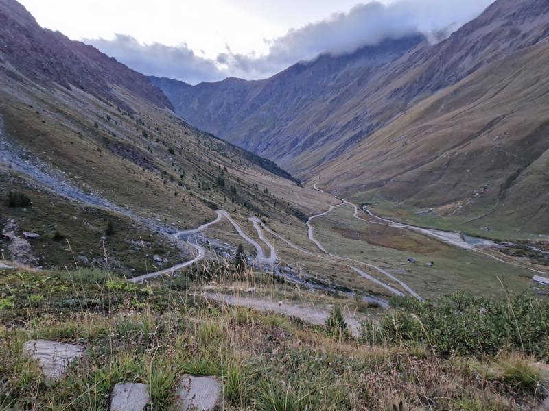
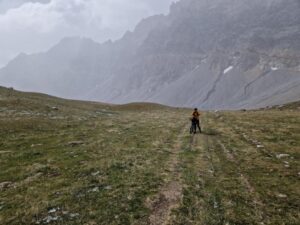
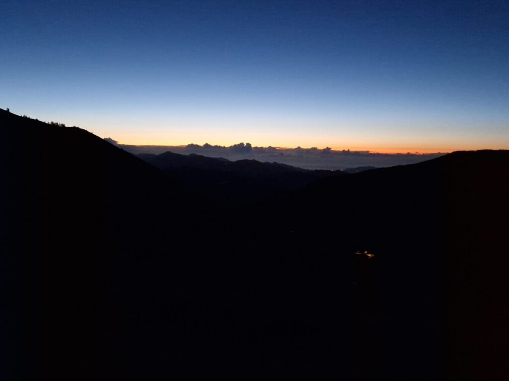
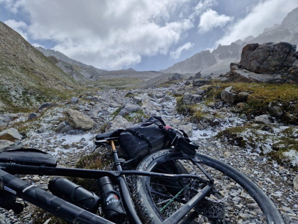
The first 8 kilometres and around 700 metres in altitude are the finest tarmac. However, the flat gravel section that follows is interrupted by a diversion via a hiking trail, first steeply downhill, then additional metres of ascent. At the reservoir, a masked cyclist comes towards me: Leona. The conditions at the top are absolutely wintry, so it will probably take me about 3 hours to complete the ascent. That seems like a lot to me and I carry on, motivated. The gravel path now climbs steeply, but is easy to cycle on. It’s getting dark. But I can still enjoy the view of the fascinating mountain world. The tinkling of bells provides the perfect backdrop, and there are still cows up here at almost 2600 metres. It throws me off my bike … Oops! Large stones bear witness to the fact that the ground has changed abruptly. I alternate between pushing and riding, some of which is quite rough. Then at some point it’s almost all pushing. A suspicious glance at my GPS device reveals that there are almost six kilometres and only about 400 metres to go to the highest point. I switch on my Lupine helmet light, as the hub dynamo-powered front light doesn’t provide enough bright light at this ‘speed’. The thick Lupine battery should still be sufficiently charged – hopefully.
While the temperatures below the tree line were quite pleasant, it is bitterly cold here. The strong wind does the rest to chill the body. I put on my rain trousers and jacket. I slip the thin merino gloves over the short cycling gloves and then some long-fingered gloves on top. It’s not very thick all together and my little finger already feels cold and numb. How will it be further up and on the descent? Will my clammy fingers still manage to slow down? My Skinfit Primaloft mittens are safely tucked away in the drawer at home. They fell victim to the minimisation attempt when packing.
Thirsty! I stop once again to take a sip from my hydration pack. But what is it? Nothing more. Empty already? No, in the light of the helmet lamp I can see the ice in the tube and the water bottle is also frozen. A glance at my Garmin … minus 6°C!!!
Why aren’t the two in front of me coming towards me? I have a bad feeling – the terrain is not going to get any easier. Finally a light ahead of me. Torsten. I complain to him that I’ve decided to turn back countless times in the last half hour, that I’m not tired of life. It doesn’t get any better on the way up, but I only have about 2 kilometres to go. If I’d made it this far, I should hike up a bit more. With one leg on the ground, Torsten – who has warm mittens, I’m envious to see – bumbles on downhill and I push on a few metres with slightly increased motivation until the next bend. Should I go back after all? Two MEs argue. Turn round immediately! No, keep going, otherwise I’ll be sorry I gave in so close to the summit. Petr comes to meet me. Another half hour or so and I would have made it. BUT: Then I’ll be at the top and then? I should also think about the way back. Continue hike & bike? For much longer at this hostile altitude? I don’t even dare to think about what could happen. The whole endeavour – pure recklessness!
Once again I have to climb over a cone of rubble. Landslide material? I can’t see it clearly, only that the track is repeatedly interrupted. Then just a few more metres and I’m at the top. It’s storming here. Get out of my gloves and take the obligatory photo of the board with all the stickers. That’s probably a mistake, I lose the feeling in my fingers in seconds. I turn round and head downhill. I can only put on my warm windbreaker a little further down, protected by a large rock. I can barely get the zip closed with my frozen fingers. How could I have got myself into such a situation? Now let’s get out of here!
I lower my seat post and try to roll down the rough path as best I can. Sometimes it goes better than I thought, sometimes it’s enough to keep my balance with one foot on the ground, other times I have to get off my bike and push. It’s exhausting, but that’s a good thing, I’m not so incredibly cold and I don’t get sleepy.
I’m almost back on better ground when I see a light. A mirage? That only happens when it’s very hot … It’s Webster. In the meantime, the storm is blowing thick flakes. And the snow is already lying on the road. I stop and have a quick word with Webster. I inform him that the pushing section starts here and that it’s freezing cold. I wish him good luck. He trudges on, I roll on. I sincerely hope that Webster is sensible and doesn’t go any further in this driving snow. I’ll write to Katie, the organiser, further down to tell her to keep an eye on him that night. I also inform Hermann that I am at the tree line and that there is now only easy terrain ahead of me. I arrive at my accommodation around one o’clock. A hot shower revitalises my frozen body parts. I sink into bed and immediately fall into a deep sleep. I wanted to be there when the boulangerie opened, which meant I didn’t have to get up so early.
Friday, 13 September 24 – bad omen????
There’s a knock at 7am. An agitated hotel manager is at the door. Because I had taken the bike into the living area without permission? No, she just wanted to know if I was ‘safe’ in my room. Because they’re looking for me. I’m beginning to understand. My tracker position is still up on the mountain. My smartphone is switched off and nobody can reach me. The organisers and Hermann are all very excited, worried and on the verge of launching a rescue operation.
In hindsight – a rescue operation would probably have come too late if I had injured myself up there. It doesn’t take long to get cold and at probably more than 6° below zero, you’re probably at risk of freezing to death. Like the Canadian woman who froze to death on the same weekend near my home town during a harmless hike.
Incidentally, Webster was sensible enough not to go any further and reached the valley safe and sound.
In the morning, Bardonecchia is deserted, the summer season is over and almost everything is closed. No bakery, no small shop in the town. I find a boulangerie, but it has no coffee and only sweet things. I shouldn’t be able to find another place to eat so quickly today.
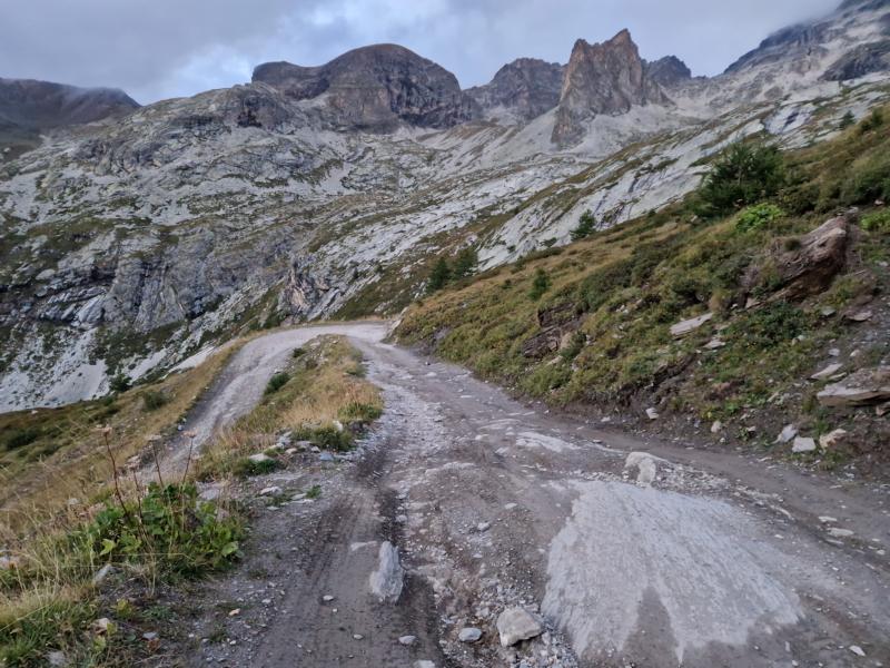
The old military road up to Colle Rho is not well maintained. It is very bumpy, stony and quite steep uphill. For me and my heavily laden bike, this means pushing uphill for almost 6 kilometres. The peaks all around are shrouded in icy mist, the sun comes through from time to time, but my water reserve has already turned to ice again. What’s more, the strong wind brings a flurry of snowflakes from time to time.
My motivation is dwindling. Every few minutes I look for a reason to stop. Photo. Eat something. Check the Followmychallenge to see where the others are. Phone Hermann to see if it wouldn’t be better to stop. Consult the weather forecast. Pity my situation. There are many reasons to stop.
Then I’m at kilometre 67, where the hike & bike should start. Well, it started 4 kilometres earlier for me … But here the military path turns into a narrow hiking trail. A sign informs me that I’m on the Pian dei Morti. Hallelujah. It’s already that far, on the plateau of the dead. A hint? No, I don’t want to be added to that list just yet. The ground here is quite easy to push along. Should I go a little further after all? If the terrain turned out to be like the Col de Ayes two days earlier, I wouldn’t be physically able to lift my bike up the stone steps. Again I have to brace myself against a squall. But now it’s enough! I turn my bike 180° in the direction I came from. Turn round now and I could probably get away from Bardonecchia quite easily by train, down the other side and I would already be back in France.
There! An orange-clad figure. Torsten. He had already persuaded me to continue on the Sommeiller, but now he’s doing the same: Gabi, you’re almost at the top now, only less than 2 kilometres to the top of the pass. Persuaded, I push on after we’ve taken photos of each other taking photos. Similar to the joke ‘Two hunters meet. Both dead!’ – two mountain bikers meet at the AlpsDivide … well, not quite checkmate yet, but both have their smartphones in front of their faces in the proof photo … In the seriousness of the situation, I have to smile a little.
I can already see the pass ahead of me. Two e-bikers are ahead of us. And they are pushing. I wonder why? The last half kilometre demands everything. The slush has melted and left behind a narrow, extremely steep muddy path. I soon have 10 centimetre sticks under my shoes. The mud is wrapped around the tyres and makes the bike a heavy one.
Movement takes place in slow motion: push the wheel forward a quarter of a metre, press the brakes, take a step forward, slide back half a step on the soapy ground. All from the front. A quick glance back, Torsten isn’t any faster.
I’m exhausted when I finally reach the top. The storm blowing unchecked up through the valley from the north is huge. I quickly put on everything I’ve got and try to get the mud off the bike. A pile of mud has even accumulated on the brake calliper. However, it is frozen solid and can be easily flicked away. The frozen material on the tyres falls away when you push it off.
Push down. The terrain here is high alpine. You have to be extremely careful not to injure yourself or roll the heavy bike down somewhere. A gust of wind catches me from the side, the bike is ripped out of my hand and the back is thrown against a rock. Shock. A check to see if everything is still intact. Apparently. Only the side bag, my Tailfin Panier Bag, has suffered a tear. What a pity!
I continue my descent. Somewhere far down I can ski again. I pass mountain pastures and then the ski village of Valfrejus. It’s deserted, of course.
Further down the valley, there’s a supermarket in the village of Modane. I’m freezing from the descent and famished. I waste a lot of time thinking about what to do next. I wait for Torsten to find out what he’s up to. But I don’t see him again. A glance at my sketches shows that I would be travelling at over 2000 metres above sea level for a long time over the next few days. The WhatsApp message from Katie that there were some alternative routes somehow passes me by. Frozen as I am, I don’t want that for another two days.
I give in to my rational self: Off to the nearest hotel and into the hot shower!
Over the next few days, I (almost) don’t waste any more thoughts like ‘if only I had … I would have …’. but the information that Torsten had got off one mountain further on and Leona too, confirmed that I had done the right thing.
I am proud to have come this far. Many of the 100 or so starters finished the race prematurely. Roughly speaking, for every 100 kilometres there was one drop-out in 10, and I still made it to km 700 and covered over 20,000 metres in elevation gain.
The last sentences … an attempt at justification? But do I have to? Aly (@right_up_my_aly), who scratched from the Race around Rwanda, put the DNF „failure“ (?) into words perfectly. I’ll try to do something similar.
I start an event, having prepared myself physically and, above all, mentally. Everything builds up to that moment of crossing the finish line within the time limit. But is that really the point? Is the value of the adventure only in those final kilometers? Or is it in everything that came before them?
I probably haven’t fully processed the DNF yet. The fire isn’t burning anymore, but it’s still smoldering. But I’ve come to understand that success isn’t always about the result—it’s about having the courage to start. And sometimes, it’s about knowing when to stop—not as a failure, but as a different kind of victory. Maybe I didn’t reach the goal I had imagined for the AD, but that doesn’t mean I didn’t complete something meaningful.
(This final text about „not finishing“ a race was written on 13.03.2025, after the Race around Rwanda, which I was able to finish with a good result.)
Saturday, 14 September 24
Drive home:
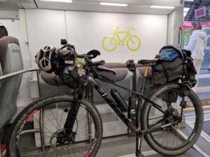
The next day, I cycle over the beautiful Mont Cenisio down into the Susa Valley. However, my plan to cycle the 600 kilometres home via Lake Como, the Maloja Pass and the Vinschgau Valley vanished into thin air when I saw the waiting train in Susa. I am back home after midnight.
I have a score to settle with the Alps Divide, now after my first DNF.
Will I start there again? The race is very tough due to the many metres in altitude, but doable. The scenery is definitely beautiful. But the weather has to play along.
Let’s see …